Specialized Services & Equipment - Water
Autonomous Surface Vehicles (ASVs) are capable of deploying several types of SONAR to measure depth of water and map the watercourse floor and channel limits.
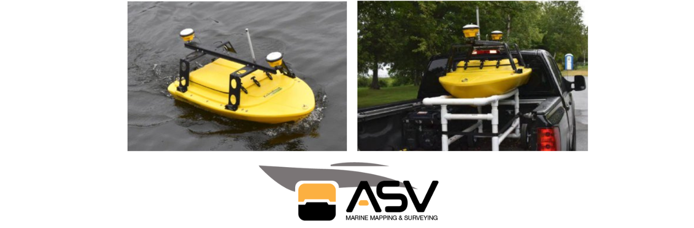
ASVs are smaller and easier to mobilize and deploy than traditional crafts used for performing bathymetric surveys. Our craft can utilize single beam SONAR in as little as 300 mm of water depth and 1.0 m for multi-beam. From a drainage channel to a lake or river, we can navigate.
Collected Data from Sonar Options:
Our Autonomous unmanned boat is capable of collecting swaths of georeferenced highly reliable data of the sea floor, river bed, channel bottom, etc. With our platform, we are able to offer many services ranging from single beam and multibeam surveys to side scan reconnaissance work. Our craft is equipped with an onboard computer and we are able to integrate many different sensors for both above and below the water surface measurements. For instance, a Velodyne LIDAR puck can be easily integrated onto the craft to capture above water surface details such as breakwaters, wharfs and bridge piers.
| |
Operational range from 0.3 - 120 metres.
Bathymetry - The equivalent of a Topographic Survey completed on land!
| |

Mobilize anywhere.
APPLICATIONS & WHERE WE CAN GO:
We go where traditional equipment can't.